June 1st 2023
How Mont Saint-Hilaire Was Formed
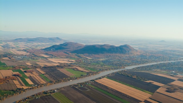
Mont Saint-Hilaire is over 400 metres high and at least 4 kilometres in diameter. It’s part of the Monteregian Hills, a range of hills that runs West to East from Oka to Mégantic.
The hills were formed about 125 million years ago when a magna column infiltrated the sedimentary rock at the earth’s crust without reaching the surface. Contrary to popular belief, Mont Saint-Hilaire was never a volcano.
The pressure and the heat of this magma column transformed this sedimentary rock into very hard metamorphic rock below the ground. The process was a bit like how cookie dough hardens after it’s baked. The sedimentary rock at the surface was crumblier than the metamorphic rock below, so over the course of millions of years, glaciers slowly eroded it away.
As the planet warmed and the glaciers melted, water inundated the region and formed an inland sea called the Champlain Sea. The earth’s crust slowly rose, as though the earth were a sponge squashed down by glaciers, getting its normal shape back as the weight of the ice lifted. The Monteregian Hills were actually islands at that time. Over the centuries, the sea gradually receded, leaving behind the terrain that we see today.
About this article
The Métro @ Montérégie team, a group of Earth science researchers and educators from McGill and Polytechnique Montréal, has put together an action-packed virtual excursion, available online: Kaleidoscope of Research on Mont Saint-Hilaire. It looks at the research work on geology, hydrology, biology and meteorology conducted at Mont-Saint-Hilaire. The text above is drawn primarily from that excursion.
Header: (Photo: Air Lmex)